Posted on Mar 06, 2015 at 15:11 PM by andy.geall79
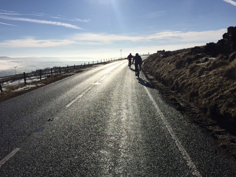
This is Long Causeway West a stretch of road from the village of Blackshaw Head covering 1.7 miles to the summit at Raw Pole. The weather on this climb can prove challenging and a head wind can make efforts difficult. The average gradient of the climb is only 2.9% with a maximum gradient of 5.9%. Climb status challenging (Blue) taking into consideration the weather conditions.
Challenging – Blue
Challenging climbs are likely to feature an average gradient between 3 and 5% and can feature some technical difficulty. These climbs are ideal for people who have a good level of fitness and want to improve their ability to climb and feel a sense of achievement.
Read More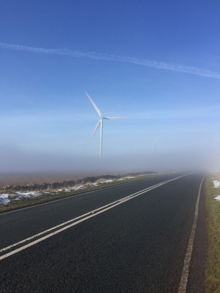
Posted on Mar 06, 2015 at 14:40 PM by andy.geall79
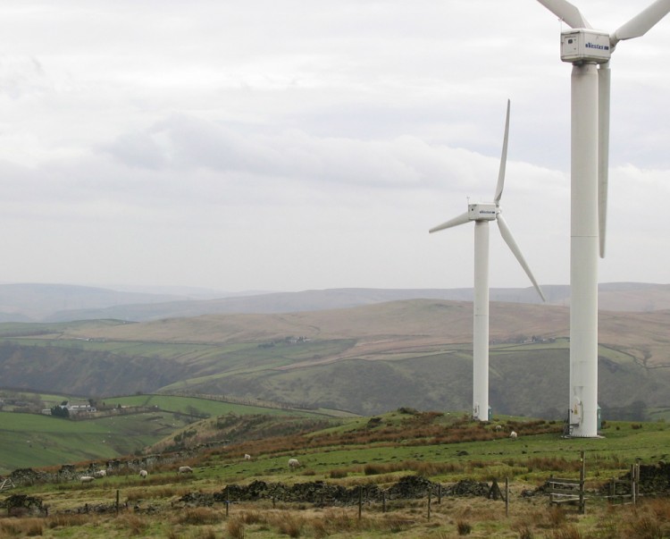
This is Long Causeway East one of the best sections of road in the area for scenery and the pure enjoyment of road cycling, add some extreme weather to the situation and your view of this could soon change. In good weather and the wind in your favour this climb will feel more like a fast rolling link than a climb, with an average gradient of 2.8% and a maximum of 8.7% the steepest parts of the climb come at the beginning. This climb crosses the Pennine Bridleway and also passes a large wind farm. This climb covers 4.9 miles and earns a hard (Red) and (Cat 3) status.
Hard – Red
Hard climbs will feature a constant level of difficulty or feature a technically difficult section. Climbs of this nature are likely to feature terrain with a gradient between 5 and 10%.This type of climb will really challenge new cyclists and require regular cyclists to increase their efforts to successfully complete this type of climb.The majority of the climbs in the Calderdale area are hard – Red.
Read More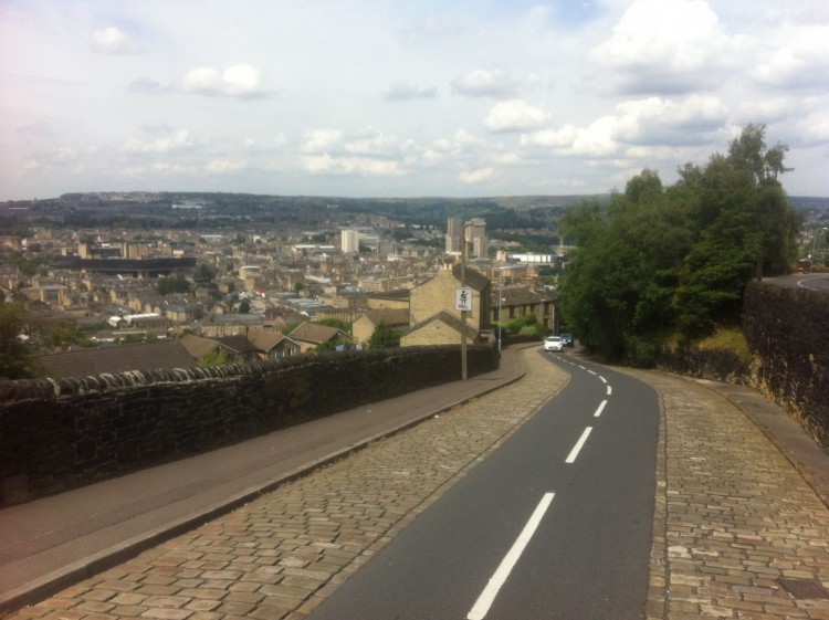
Posted on Mar 06, 2015 at 14:29 PM by andy.geall79
Southowram Bank is one of the steepest climbs in the Halifax area and connects the east side of the town with the village of Southowram. With an average gradient of 10.6% and a maximum of 15.4% this is a tough climb. Accessing the climb can be slightly tricky from Bank Bottom as the right turn onto Southowram Bank is blind. Approaching on Charlestown Road is much easier. The final section of this climb features a narrowing of the road and cobbled sections on both sides; this is worth considering as you choose to ride in the centre of the road or over the cobbles. Climb status very hard (Double Black) and (Cat 4).
Very Hard – Double Black
A Very Hard – Double Black climb will feature super technical difficulty and really challenge amateur and profession cyclists alike. Climbs of this nature are likely to have an average gradient over 10% and sections over 15% gradient make these climbs seriously tough. Calderdale has a number of road and mountain bike climbs that sit in this category.
Read More
Posted on Mar 06, 2015 at 14:17 PM by andy.geall79
This is another short climb in the Luddendenfoot area covering 0.8 miles with an average gradient of 6.8% and a maximum of 15.3%. The first 3rd of this climb is really easy and the road even descends slightly in parts, however once you go under the railway the challenge begins and the tarmac ramps up. After the first real rise there is a short descent before you hit a wall of tarmac all the way up to Pinfold Lane. Climb status very hard (Double Black) and (Cat 4).
Very Hard – Double Black
A Very Hard – Double Black climb will feature super technical difficulty and really challenge amateur and profession cyclists alike. Climbs of this nature are likely to have an average gradient over 10% and sections over 15% gradient make these climbs seriously tough. Calderdale has a number of road and mountain bike climbs that sit in this category.
Read More
Posted on Mar 06, 2015 at 14:05 PM by andy.geall79
This is a super short climb at 0.6 miles, the first section is easy on Boy Mill Road however once you cross the railway bridge this climb becomes a real challenge. With an average gradient of 9% and a maximum 16.1% this climb earns it very hard (Double Black) and (Cat 4) status.
Very Hard – Double Black
A Very Hard – Double Black climb will feature super technical difficulty and really challenge amateur and profession cyclists alike. Climbs of this nature are likely to have an average gradient over 10% and sections over 15% gradient make these climbs seriously tough. Calderdale has a number of road and mountain bike climbs that sit in this category.
Read More
Posted on Mar 06, 2015 at 13:57 PM by andy.geall79
This is one of Calderdale’s hidden climbs leaving the village of Luddendenfoot in the valley floor this climb covers 1.1 miles over an average gradient of 10.4% and a maximum of 17.9% putting it in the super tough category. A little navigation is needed on this climb as you take a tight hairpin turn left from Danny Lane to Greystones Road about a 3rd of the way up. The gradient eases after 0.6 miles but is no means easy staying at around 10%. Climb status very hard (Double Black) and (Cat 3).
Climb Status
A Very Hard – Double Black climb will feature super technical difficulty and really challenge amateur and profession cyclists alike. Climbs of this nature are likely to have an average gradient over 10% and sections over 15% gradient make these climbs seriously tough. Calderdale has a number of road and mountain bike climbs that sit in this category.
Read More
Posted on Mar 06, 2015 at 13:47 PM by andy.geall79
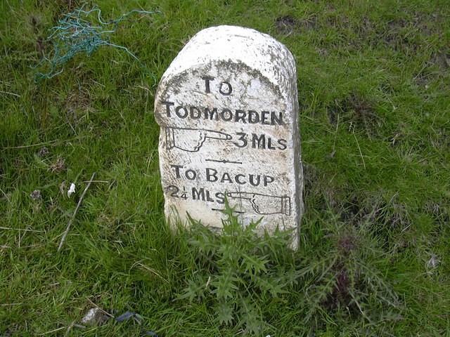
This climb starts in the Town of Bacup and heads up the A681 towards Todmorden, the majority of the climb is lined by housing until you reach the upper sections and moorland becomes more prominent. The climb is not overly tough with an average gradient of 4.9% and a maximum of 7.8%; however a not uncommon head wind can make the climb feel a lot tougher than it is. Climb status hard (Red) and (Cat 4).
Hard – Red
Hard climbs will feature a constant level of difficulty or feature a technically difficult section. Climbs of this nature are likely to feature terrain with a gradient between 5 and 10%. This type of climb will really challenge new cyclists and require regular cyclists to increase their efforts to successfully complete this type of climb. The majority of the climbs in the Calderdale area are hard – Red.
Posted on Mar 06, 2015 at 12:29 PM by andy.geall79
This is a short 0.8 mile climb and if you have reached this point by bike you will have ridden part of Bacup Rd or all of the Todmorden Rd climbs. This climb starts tough and becomes easier as you reach the top, with an average gradient of 5.9% and maximum of 10%. At the top by the closed Dog and Partridge pub there are two options, continue right and follow the very steep descent into Todmorden Town Centre or take the preferred left turn onto Tower Casueway that provides a gateway to the A646 Burnley Rd. Climb status hard (Red).
Hard – Red
Hard climbs will feature a constant level of difficulty or feature a technically difficult section. Climbs of this nature are likely to feature terrain with a gradient between 5 and 10%. This type of climb will really challenge new cyclists and require regular cyclists to increase their efforts to successfully complete this type of climb. The majority of the climbs in the Calderdale area are hard – Red.
Read More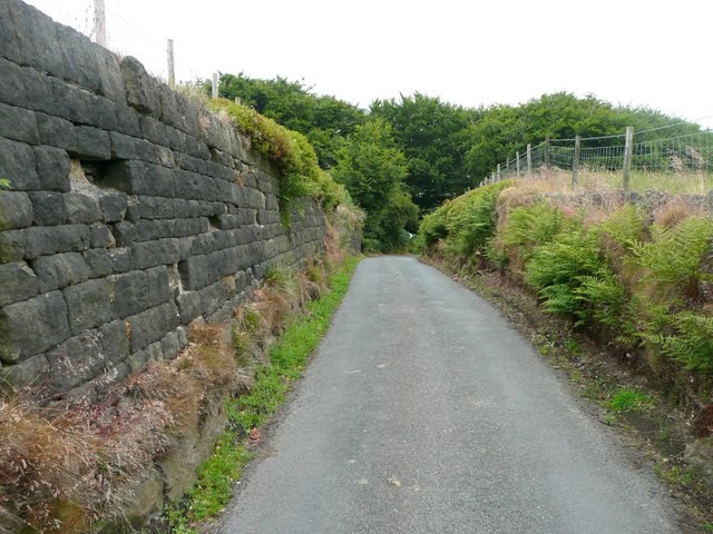
Posted on Mar 06, 2015 at 12:18 PM by andy.geall79
Welcome to 1.2 miles of pure effort, this is probably the toughest climb in the Todmorden area with an average gradient of 9.7% and a seriously steep maximum gradient of 18.5%. The start of the climb is kind for about 200m until you hit a wall of tarmac in the form of Doghouse Lane, the gradient decreases as you hug the top of Eawood and Buckley Woods. After that point there is a short rest period before kicking up again to Tower Causeway. Climb status very hard (Double Black) and (Cat 3).
Very Hard – Double Black
A Very Hard – Double Black climb will feature super technical difficulty and really challenge amateur and profession cyclists alike. Climbs of this nature are likely to have an average gradient over 10% and sections over 15% gradient make these climbs seriously tough. Calderdale has a number of road and mountain bike climbs that sit in
this category.
Posted on Mar 06, 2015 at 10:48 AM by andy.geall79
This climb cuts through the steep sided valley of Gauxholme before heading up to the hamlet of Clough Foot and the baron lands of Bacup Rd. This is a long climb covering 3 miles and sunlight in the winter months is a premium on the lower sections. With an average gradient of 4.6% and a maximum of 8.8% this climb has a few hidden surprises. For many you will either love or hate this climb. Climb status hard (Red) and (Cat 3).
Hard – Red
Hard climbs will feature a constant level of difficulty or feature a technically difficult section. Climbs of this nature are likely to feature terrain with a gradient between 5 and 10%. This type of climb will really challenge new cyclists and require regular cyclists to increase their efforts to successfully complete this type of climb. The majority of the climbs in the Calderdale area are hard – Red.
Read More
_768_600_s_c1.jpg)