Posted on Aug 18, 2015 at 13:19 PM by andy.geall79
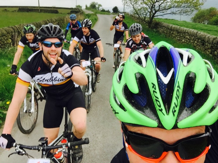
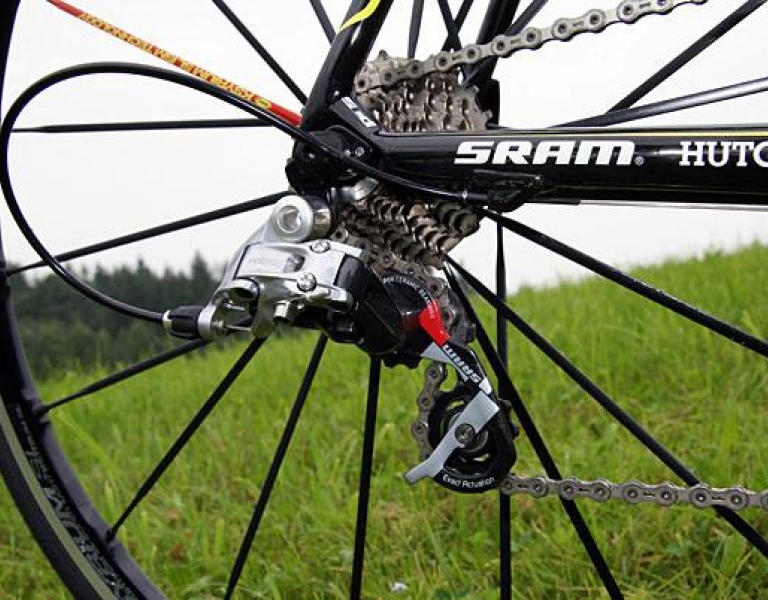
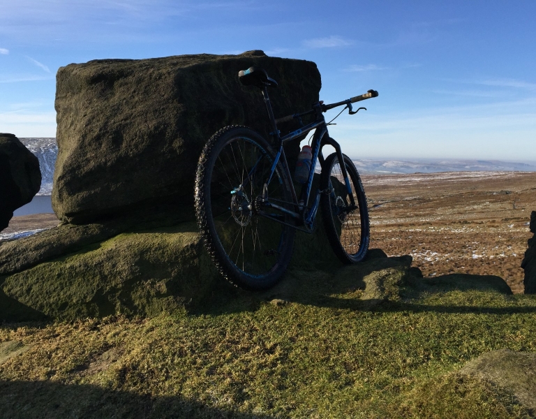
If you want to go out on a big bike ride for the day, and by the day we mean up to 24 hours maybe more; the Calderdale Big Dog provides such a challenge. The route exists after 7 local mountain bikers set out to conquer 50 of the best off road climbs in Calderdale. The route covers a 152 miles and climbs a staggering 23,000ft, big numbers in the world of mountain biking. At this point you are probably thinking why would a group of people attempt this? The simple answer was to raise funds for Bipolar UK and obviously complete the challenge of a lifetime. The team rose over £3K for the charity completing the route in 23 hours.
So how hard is the actual route….honestly pretty brutal, due to the route being based on climbs the route very much follows a up and down spiked profile with very little time spent on the flat lands just spinning away. If you are not familiar with the area Calderdale is made up of steep sided valleys that offer some of the best natural mountain biking in the UK.
The route starts and finishes at the Stubbing Wharf Pub, Hebden Bridge and hits the hills pretty much from the off. Spencer Lane a steep cobbled climb offers an early challenge before the route descends to Mytholmroyd. Leaving the village things get pretty tough in the form of Stake Lane a road climb that merges into some real challenging off road terrain. The route continues up the Luddenden Valley before picking off a few climbs around Wainstalls and Ogden. At this point you have covered 30km and its time to descend to Halifax before you climb up to Southowram. The top of this climb offers some fantastic views over Halifax looking up the Calder Valley. The route continues to some tough climbs around Copley that include Copley Wood and the technical and steep Hollas Lane.
As you head south the route heads through Greetland,Holywell Green and Sowood chalking off a number of climbs in the process. Approaching Scammonden the route becomes complex for the first time looping back and forth around the reservoir before moving onto the tricky Fiddle Lane. In the dry you may clear this one with a boat load of luck but I bet for many you will be off and pushing.
Rishworth and the Ripponden Valley provide the next test with some cheeky steep little digs before you head to the more rural location of Cragg Vale. The climb out of the village is long but the terrain is kind, appreciate this moment as Todmorden provides a true challenge of climbing and mental toughness. The pain begins as you descend the packhorse trail from Withens Gate to simply turn around and head back up the cobbled wall. The pattern of cobbles continues as you pick off a few climbs that feature on the Mary Towneley Loop.
As you leave Todmorden the route heads to its most rural location. Hugging the hills above Walsden along Long Causeway is followed by the climb of Flower Scar Road. Flower Scar Road offers a reward in the form of a long descent to Cornholme before climbing up one of the steepest roads in Calderdale, Pudsey Road. To add disappointment, this climb does not qualify as an off road climb.
At the summit of Pudsey Road 156km have been ridden and there are still plenty of hills on offer. The challenge continues as you begin the climb of Widdop Reservoir to Gorple Gate, referred to by locals with a less affectionate name. Don’t let this climb confuse you the terrain over the dam wall and beyond is easy before the climb ramps up on loose terrain.
Welcome to the Calder Valley between Hebden Bridge and Todmorden, this section of the route is tough climbing one side of the valley and then the other. You eventually escape after doing battle with Duke Street and London Road as you head on to tackle the Ragley Collection. The Ragley Collection is made up of 3 climbs situated North West of Hebden Bridge. The long climb up the woodland is the easy one of the three with the climb to Popples and Hepstonstall having more of a sting in the tail. The Ragley climbs traverse nicely into Hardcastle Crags as the end of this epic mountain bike ride is near. The Calderdale Big Dog ends descending the same climb you and your bike first completed hours, maybe a day before.
Realistically not many people are going to attempt this ride in one go, think that is best left for the extreme and crazy few of the mountain bike community. However the route could be ridden over a number of days or simply pick a section and enjoy what Calderdale has to offer.
Read More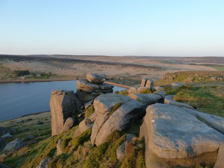
Posted on Mar 11, 2015 at 12:05 PM by andy.geall79
Starting a Mays Farm Shop above Colden take the opportunity to stock up on supplies for your ride or enjoy a coffee before you start the pedals turning. This route covering 36.6km of rural terrain is ideal for the hardened roadie on a training loop or for those who like a challenge at a leisurely pace. The route isn’t flat but at the same time you wouldn’t describe the climbs as massive. As the route leaves Colden you are instantly rewarded with a descent before taking the country road to Widdop with plenty to see along the way including Blake Dean and Widdop Reservoir, ideal locations to stop and enjoy the scenery. The route continues to Ridehalgh Lane where the road is best described as impressive as it cuts through the hillside on the descent to Thursden. The route then picks up the old Halifax Road before you make your way to the Lancashire village of Worthorne an ideal place to stop and enjoy the atmosphere. Leaving Worsthorne you head south before linking back to Long Causeway and the stretch back to the start. The weather on this section especially the wind can play a huge part to how quickly you progress, on a good day with little wind the Long Causeway can be open to the elements. As you descend down the hill into Blackshaw Head follow the road to a well deserved drink at the New Delight Inn before heading back to the start.
The anti-clockwise nature of this ride means you can keep cycling as there are very few right turns.
Red Hard, featuring some climbs with a 10% gradient and descents featuring technical difficulty.
Read More
Posted on Mar 10, 2015 at 15:22 PM by andy.geall79
A short but well used cycling corridor from Littleborough to Warland. This corridor climbs steady 69m for 2.8km to Warland on the Calderdale boundary, the road continues outside the corridor and on to the village of Walsden and the town centre of Todmorden. This corridor is a great option for cyclists who wish to access Calderdale avoiding the many hills. This road route runs parallel with the canal towpath that provides a more leisurely path into Calderdale.
Read More
Posted on Mar 10, 2015 at 15:16 PM by andy.geall79
The B6138 known locally to cyclists as just ‘Crag’ the road descends approximately 338m over 9.5km from Blackstone Edge to Mytholmroyd. The first part of this road is exposed to open moorland and the wind can blow in a range of directions. Just over half way is the small village of Cragg Vale home to the
Robin Hood Pub and Hinchcliffe Arms, leaving the village the route follows the tree lined valley before reaching the outskirts of Mytholmroyd.
Posted on Mar 10, 2015 at 15:10 PM by andy.geall79
The B6138 known locally to cyclists as just ‘Crag’ the road descends approximately 338m over 9.5km from Blackstone Edge to Mytholmroyd. The first part of this road is exposed to open moorland and the wind can blow in a range of directions. Just over half way is the small village of Cragg Vale home to the
Robin Hood Pub and Hinchcliffe Arms, leaving the village the route follows the tree lined valley before reaching the outskirts of Mytholmroyd.
Posted on Mar 10, 2015 at 14:47 PM by andy.geall79
This stretch of road is more of a link than a direct cycle corridor connecting Littleborough and Ripponden but also provides an option to descend on the B6138 (Cragg Vale) home of the longest continuous downhill road in England. From the Littleborough side the climb is just shy of 5km and starts off gradually and ramps up as it hugs the moorland up to the summit at the White House Pub. From Ripponden the climb is 7km to the summit at Blackstone Edge Reservoir and bypasses Baitings Reservoir on route, stage 2 of the 2014 TDF witnessed the best cyclists on the planet ride this section in reverse as they descended at high speed. In total from the Ripponden side the stretch of road is 11.8km to Littleborough, climbing 264m and descending 268m.
Read More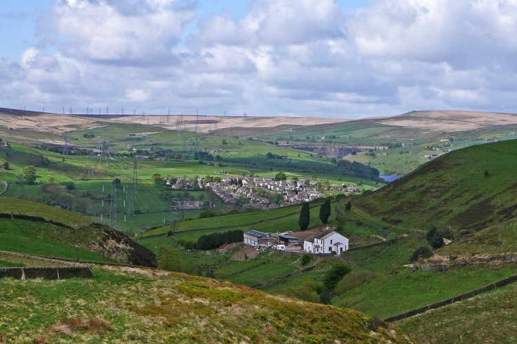
Posted on Mar 10, 2015 at 14:37 PM by andy.geall79
From Denshaw one climb and a gradual descent to Ripponden, the corridor is 13.2km long and includes 223m of climbing and 348m of descending. The majority of the corridor flows through a rural landscape before the area becomes slightly more ubran as you approach Ripponden village. The 2014 Tour De France will passed through this tiny Yorkshire village on Sunday 6th July.
Read More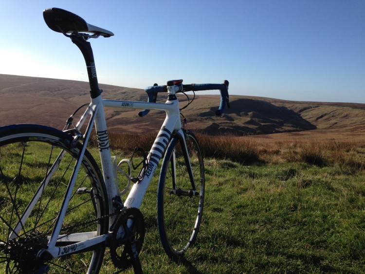
Posted on Mar 10, 2015 at 14:28 PM by andy.geall79
A beautiful corridor that begins in Denshaw and climbs past the Dowry Reservoir to Buckstones and onto Sowood, the views from the car park at the summit of the climb are fantastic on a clear day. The corridor in total is 14.5km long and incorporates the road of Marsden Gate to Sowood, with 265m of climbing and 250m descending on offer this is a great route into Calderdale. At Buckstones there is the option to take the B6114 as an alternative as this is a great corridor in its own right. From Sowood it is possible to descend through Stainland and Holywell Green to the village of West Vale.
Read More
Posted on Mar 10, 2015 at 14:04 PM by andy.geall79
The main road corridor linking Kirklees at Cooper Bridge and Calderdale at Brighouse, this corridor is heavily used by both motorists and cyclists. The corridor is not particularly pleasant and features the junction 25 roundabout off the M62. The corridor is only popular as there are very few direct alternatives available.
Read More
Posted on Mar 10, 2015 at 13:51 PM by andy.geall79
An unusual corridor with a mix of urban and rural scenery, the corridor begins between the Bradford district locations of Haworth & Cullingworth and acts as a direct route for motorists into Halifax. The corridor 12.6km in length climbs a 175m and descends 260m to the outskirts of Halifax, Calderdale’s main town. Cyclists would be advised to seek alternative routes into the town centre at the junction of Ovenden Rd and Shroggs Rd to avoid the busy Orange Street roundabout.
Read More
_768_600_s_c1.jpg)