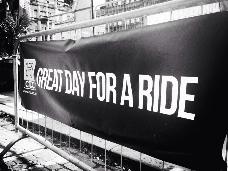
Posted on Mar 03, 2016 at 13:18 PM by andy.geall79
This 44km road ride starts in the small village of Walsden outside the local train station. The village has a small number of shops and facilities and a cracking fish and chip shop that opens during the week. At Cycle Calderdale we would advise you complete the route before tucking into some of Grandma Pollards finest delights.
Back to cycling the route heads south along the A6033 towards Summit which is famous for the Summit Tunnel Railway fire in 1984. From this point the road is fast flowing down to the town of Littleborough. At the traffic lights you turn left and head onto the first climb of the ride ‘Calderdale Road Climb 03’ Blackstone Edge. This climb is the toughest of three climbs that share the same summit point, one of which is the famous ‘Calderdale Road Climb 01’ Cragg Vale.
The Blackstone Edge climb is a real mixed bag with steady gradients on the lower slopes before the road ramps up hugging the hillside. The weather can be a real feature on this climb and help or hinder your progress. The road is open on the steeper slopes and the views down the valley you started from are superb on clear days.
As you reach the top you continue on the A58 down a fast descent towards Baitings Reservoir, from here the route takes on a rural road twist and follows some of Calderdale’s quiet country lanes. This road network is quite complex and some of the roads merge into farm tracks and bridleways. Carrying a map of the route or downloading the map file is advisable for this section of the ride.
After snaking around the country roads of Calderdale the route links back into the climb of ‘Cragg Vale’ and heads north and downhill to the village of Mytholmroyd which is a great place to refuel with a range of facilities on offer.
Leaving Mytholmroyd the route is straight forward as you follow the A646 to Todmorden, turn left at the roundabout and continue back to the start.
Read More
Posted on Mar 02, 2016 at 14:15 PM by andy.geall79
The White & Red Roses Mini Road Ride brings you another offering of hilly cycling around the Upper Calder Valley town of Todmorden.
The route starts in the centre of the town and heads east towards Hebden Bridge, on the outskirts of the town you embark on the first climb of the route ‘Calderdale Road Climb 40’ Cross Stone Road. The climb breakdowns into 3 sections and begins with a super steep slope that twists up the hillside. This follows with a short rest period as the route hugs the hillside and the climb ends with another sharp shock up to the landmark of Great Rock.
From here the route continues to climb until you reach Long Causeway and one of the high points on this ride. On a clear day you can look behind and admire the views down the Calder Valley.
The next part of this ride is truly fantastic as long as the wind isn’t in your face. From this point you gradually descend to Mereclough and the road kicks up on occasions but nothing challenging. On most days this entire section of road is fast rolling and enjoyable as a cyclist.
Look out for the sharp left turn onto ‘Shoebox’ it can be easily missed as you descend at speed. The route uses country lanes to link into the hamlet of Overtown before you descend further for a short pedal on the A646 Burnley Rd.
As you exit the Burnley Road the route follows a pleasant almost traffic free road through Buck Clough which is part of the National Cycle Network. This road is steep in parts but cuts off the corner and avoids using a busy road junction before connecting with the A671 Bacup Rd. The climb up to the summit is gradual and for an A road has relatively low levels of traffic.
With 21km in the bag you pass the shutdown Deerplay pub and descend to Bacup through the small village of Weir. The lower sections of this road have recently been resurfaced (Dec 2015) providing a super smooth descent to the Lancashire town.
From Bacup the route follows ‘Calderdale Road Cycling Corridor 01’ a popular route used by road cyclists to access Calderdale. The corridor covers 7.5km and this is the kind side to ride as the climb to the summit is much shorter and sheltered from the elements.
Once you reach the summit it’s all downhill to Todmorden for some well-deserved refreshment, enjoy the descent to Shade as it twists and turns down the hillside, through woodland and into the small hamlet of Gauxholme, Todmorden town centre is a short pedal from this point.
Read More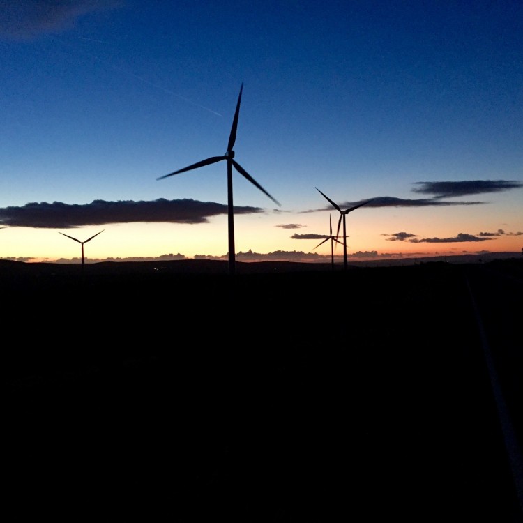
Posted on Mar 01, 2016 at 14:42 PM by andy.geall79
Welcome to Todmorden and the ‘Lanes above the Den’ road ride. Firstly you are probably thinking just over 30km is short for a road ride, however appearances can be deceiving and this route has a sting in the tail with over 700m of climbing on offer up some of the steepest gradients in the area.
The route starts in Todmorden outside the old cinema building and heads west with Centre Vale Park on your left. At the far side of the park you embark on the first climb of the ride up the woodland road behind the park before traversing onto open moorland and Flower Scar Road. At the summit of the climb take the opportunity to look back down the Calder Valley.
From the summit the route descends down a twisty narrow road that can feature a number of loose stones from running water, so please descend with care. Back in the bottom of the valley you link up with the A646 and briefly head in the direction of Todmorden before turning onto Calderdale Road Climb 38 (Pudsey Rd & Shore New Rd). This climb is by no means cuddly like the bear, in fact the complete opposite, firstly its long covering 1.2 miles and features an average gradient of 10%, to make things even tougher the road ramps up to 18.9% at its steepest point.
At the top again appreciate the view in both directions as you are unlikely to see the landscape on a return visit look the same. The reason being the light and weather conditions dramatically alter the scenery, if possible aim to visit this part of the world at dusk or dawn.
The route continues along Long Causeway to Blackshaw Head and one of our personal favourite descents in the area. The road down into the village is open and flowing allowing your bike to coast and provides the option to apply the brakes as desired. Please reduce speed through the village as there are no pavements and pedestrians and horse riders move around the village.
The route descends to the New Delight Pub and the option to take on some liquid refreshment, alternatively just off route is the ‘Aladdin’s Cave’ in Mays Farm Shop that sells pretty much everything and will make you a quality cup of Yorkshire Tea. The shop is one of the areas hidden gems popular with both road cyclists and mountain bikers.
The area of Slack is situated on the outskirts of the historic town of Heptonstall, this route bypasses the town but there is the option to visit with those prepared to cycle on cobbles. The original route can be simply picked up by continuing through the village and linking back onto Heptonstall Road.
From Mytholm just outside Hebden Bridge you cycle in the valley floor and the flattest part of the route. Just after Eastwood you head to the hills for the final climb of the day that takes in the picturesque Mankinholes and Lumbutts with Stoodley Pike monument in the background.
The final kilometres of this ride are effortless as you descend to the outskirts of Walsden before taking the hairpin turn back to the main road and Todmorden Town Centre. Reward your efforts on the climbs by sampling what the town has to offer.
Posted on Feb 24, 2016 at 14:24 PM by andy.geall79
This route starts in the emerging cycling town of Sowerby Bridge, more businesses in the area have recently become cycle friendly and the opening of Happy Days Cycle Café and Bike Shop will give the town a cycling boost.
Sowerby Bridge isn’t commonly known for off road trails in Calderdale but there are plenty of hidden gems above the town to explore. The route begins with a steady spin along the valley floor to warm the legs up before the first climb of the day Calderdale off Road Climb 40, ‘Hollas Bridge to Norland Town. To be completely honest this is one tough climb with ever changing features. The bottom section of the climb can often have a stream flowing and beyond that a mix of rock sizes can hinder your progress. To top things off this climb is narrow and brutally steep until you reach the cobbled sets to the quiet country road.
As you continue to climb on the country roads the route reaches the flat lands surrounding Norland Moor. The moor itself popular with mountain bikers has recently been under the spotlight regarding its use and because there is no definitive cycling over the moor our route will be bypassing this unique landscape.
From Norland Moor the route plunges downhill linking back into the bridleway network and the old track bed of Sowerby Bridge to Ripponden Train Line (1878 to 1958). Rumour has it that it was the most expensive railway ever built in the country at the time, today it is popular with mountain bikers and walkers as it cuts through the landscape. The track bed depending on the time of year can be a real muddy hack or fast flowing in sections in the dryer months.
At Kebroyd the route climbs up out the valley to the quiet area of Soyland and beyond. From this point this entire hillside is littered with bridleways and our route picks its path over a multitude of terrain with surrounding views.
At around 20km you hit the descent of Stake Lane (Calderdale off Road Climb 9) in reverse. We think this is one of the best short descents in the area, steep, technical and challenging. This descent takes you into the small village of Mytholmroyd which is a good place to refuel.
The final part of the route follows the valley floor as you simply spin through the flat land of Calderdale back to Sowerby Bridge.
Read More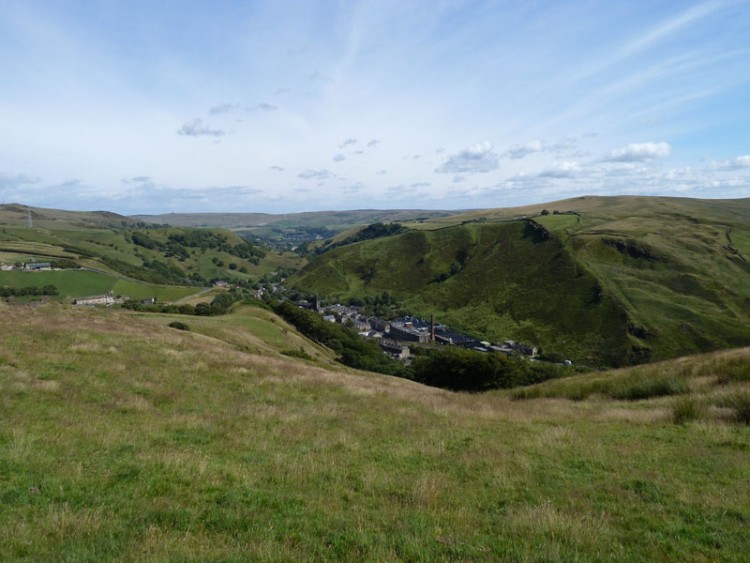
Posted on Feb 19, 2016 at 09:36 AM by andy.geall79
The Todmorden Packhorse mountain bike ride only ventures 11km away from the town centre at its furthest point, but covers over 25km of terrain packing a punch and stamping its authority as a quality natural route.
The route begins in the town centre of Todmorden which boasts the steepest hills of all the Calderdale towns in our opinion and proves its worth from the off taking on ‘Pexwood Packhorse’ Calderdale off Road Climb 21. The climb is super steep and technical with the elevation gain surprising as you look down into the valley floor and admire the historic railway and canal architecture.
After the first big climb of the day the route picks up quiet country lanes and bridleways before linking into the restoration project of Flower Scar Road. This road hugs the skyline and offers some epic views on a good day down the Calder Valley. Riding through this section of the route is fast rolling and this continues as you descend to the little village of Portsmouth. The final part of the descent will put a smile on the face of those who like it steep with technical features.
The road breaks away from the trail briefly and follows the A646 west before heading off road up a mix of bridleway and track to the huge windmills at the wind farm situated off The Long Causeway. This is one of the areas high points and the views on a clear day can be spectacular from dawn to dusk as the light impacts the land.
The true packhorse adventure begins at this point as the route descends on a short road section before linking into 4.5km of flowing packhorse trail. This part of the route hugs the side of the valley and gradually descends overall although there are a few points where the route kicks up. Depending on the time of year and recent rainfall this part of the route can be fast and flowing or a technical hack, both of which rides extremely well all year round.
The final descent on this ride is one of our personal favourites here at Cycle Calderdale and begins shortly after you leave the golf club and head up the tarmac. The first part features a fast farm track style bridleway to the rural road network, before taking a hard left along some woodland single track to a hidden hamlet. From this point you pick your way through the old stone buildings and descend a technical bridleway that traverses till you reach the car park at the bottom.
Head back to Todmorden on the main road and sample what the town has to offer.
Read More
Posted on Feb 16, 2016 at 15:12 PM by andy.geall79
This ride starts in the Upper Calder Valley town of Todmorden and dips two wheels firmly in the counties of Yorkshire & Lancashire. Featuring 5 challenging climbs of mixed terrain and variety of natural trails this mid distance mountain bike route is superb.
The best time of year to
ride this route is in spring or summer or when there’s a ground frost.The majority of the terrain up to Warland Reservoir is hard packed and traction is good. However from Warland Reservoir to White Holme Reservoir the permissive path is made up of natural peat. This section when firm under the knobbly tyres offers some of the best natural and flat single track in the area, covering over 5km the narrow path will keep you guessing.
Prior to the section above the route features a healthy slice of the Mary Towneley Loop a circular route that makes up part of the Pennine Bridleway National Trail. The Calderdale sections of the MTL follow the cobbled sets of the old packhorse routes and the Lancashire sections offer a challenge of moorland and rocky terrain.
Fast forward downhill on the road descent to Cragg Vale village and the gateway to Withens Clough. The route climbs steadily compared to some of the ascents in Calderdale and on a clear day the views at the top are excellent with Stoodley Pike in the back drop. The route ends with some fun
descents down the super steep cobbled sets to Mankinholes and then again through the woodland of Height Wood. Just before the river crossing into Height Wood there is a technical rocky section that seems to change as the loose rocks move around on the trail floor, aim to get to the gate without ‘dapping’.
Relax on the towpath back to Todmorden and sample what the town has to offer. You may want to take a short detour at the end of the ride to check out the Cycle Factory Bike Shop.
Route Status: Hard Red
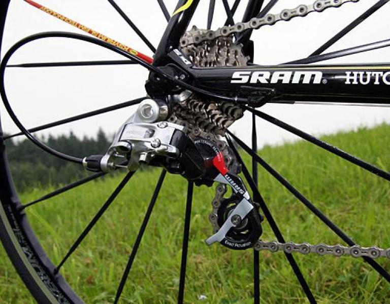
Read More_750_422_90.JPG)
Posted on Dec 01, 2015 at 11:32 AM by andy.geall79
Starting at the cycle friendly Stubbing Wharf Pub Hebden Bridge this short mountain bike ride features some of the best descents in the area. This route is hilly compared to some of the other popular mountain bike locations in England and effort on the climbs is rewarded on the descents.
This ride features four great descents three of which will put a guaranteed smile on your face and offer experienced mountain bikers a good technical challenge. The first is located in the Ragley area and is a reserve of off road climb No 24. This descent is made up of single track, loose rock and twisting corners and can feature shallow streams in parts. The top of the descent is open to nature before you head into the wooded section and the foot of the descent. Before you take on the first descent of the day it is worth stopping at Mays Farm Shop to enjoy a brew and some cake or simply restock the energy levels from an establishment that sells pretty much everything.
As we mentioned earlier climbs are earned and the ‘Blue Pig’ descent is no different. The first part of the climb up to Hepstonstall village is tricky before you ride over the cobbled streets. The ‘Blue Pig’ begins with some smooth single track that features a few stepped drop offs before heading down a steep fire road. Take care at this point as the route crosses a road before entering the more technical part of this descent that features a number of obstacles including large rocks, sets, mini rock gardens and large stepped drop offs. This descent truly has a bit of everything and keeps you thinking throughout.
At this point you have reached Hardcastle Crags and there is a mini challenge on offer in the form of a very short but technical climb that cuts through the woodland, clear this in one and be proud of your efforts. For those who simply want to roll up at a leisurely pace the road rolls up on a parallel route.
Following a few miles of gradual Calderdale climbing you reach the descent down to Grain Water Bridge. We wouldn’t describe this as a classic but it’s certainly open fast and flowing. This descent is also off road climb No 30 in reverse.
From Grainwater Bridge you can take things easy as you spin along Haworth Old Road before joining the A6033. This section of road rolls quite quickly even on a mountain bike and it’s easy to miss the entrance to ‘Mini Stoodley’ descent which cuts right off the road down a steep packhorse trail into the woodland. There is a slight climb as you cross the river before entering a technical rutted stone bridleway that twists and turns back down to Hardcastle Crags. If we had a £1 for every rider that said that was brilliant we be rich folk at cycle Calderdale.
Completing the ride you simply roll out of the ‘crags’ on the road and merge with the A6033 and descend to the town of Hebden Bridge to enjoy one of the many cafes or pubs. The best way to ride back to the start is to head west on the canal towpath that takes you directly back to the Stubbing Wharf Pub.
Read More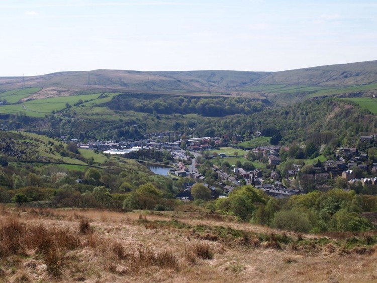
Posted on Nov 04, 2015 at 13:27 PM by andy.geall79
Inner Cyclist have been busy at work throughout the summer of 2015 to create two ‘Really Big Cycle Guides’. To keep things simple we split Calderdale in half and produced a East and West cycle guide. The cycle guides are aimed at families and beginners and explore the valley floor routes of Calderdale.
The west guide features a large map from Warland to Sowerby Bridge and mini maps and features on Walsden, Todmorden, Hebden Bridge, Mytholmroyd, Sowerby Bridge, Luddedenfoot and Cragg Vale Coiners. This guide also features the areas points of interest so why not have a break from pedaling and explore what Calderdale has to offer.
Read More
Posted on Nov 04, 2015 at 12:47 PM by andy.geall79
Inner Cyclist have been busy at work throughout the summer of 2015 to create two ‘Really Big Cycle Guides’. To keep things simple we split Calderdale in half and produced a East and West cycle guide. The cycle guides are aimed at families and beginners and explore the valley floor routes of Calderdale.
The east guide features a large map from Warland to Sowerby Bridge and mini maps and features on Sowerby Bridge, Near Halifax, Salter Hebble, Elland, Brighouse and Outdoor Activities. This guide also features the areas points of interest so why not have a break from pedaling and explore what Calderdale has to offer.
Read More
Posted on Nov 03, 2015 at 09:38 AM by andy.geall79
Starting in the heart of Brighouse this 8.9km route follows the Calder & Hebble Navigation to the outskirts of Sowerby Bridge. There is plenty of wildlife on route and a nature reserve at Cromwell Bottom. The route boasts a number of standard and unique lock gates and features some stunning architecture. At Salterhebble Basin look for the canal, road, railway and river passing over and under each other.
This route is ideal for families and beginners, cycling from Brighouse to the outskirts of Sowerby Bridge and back will cover 17.8km with a few very short inclines at the lock gates. There are options on the route to branch off up the Hebble Trail to Halifax or continue on the towpath to Sowerby Bridge Town Centre. Both Sowerby Bridge and Halifax have a train service to Brighouse.
The 8.9km linear route is 95% off route with a road section at Elland Bridge that can easily be walked by less confident cyclists.
Read More
_768_600_s_c1.jpg)